Unlimited Trails
You’ll find the right hike in Radium, no matter your preference! We’ve got waterfalls, viewpoints, and lakes to discover.
There are so many beautiful trails leaving right from the Village.
Find tucked-away trailheads leading to stunning viewpoints, waterfalls, rivers, and lakes. Skip the long drives and head out on a trail right from town.
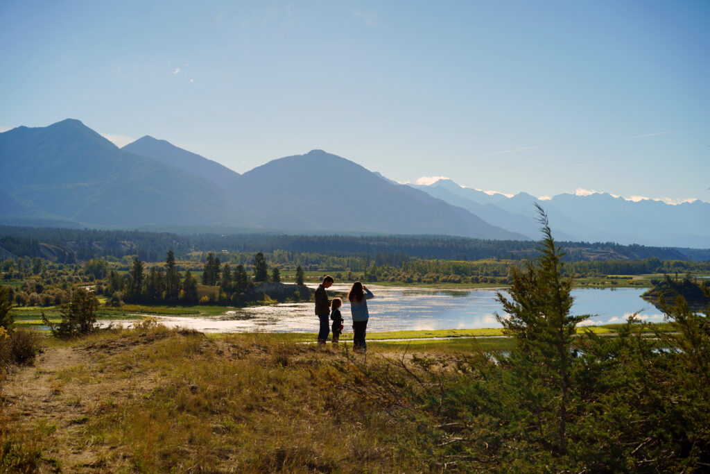
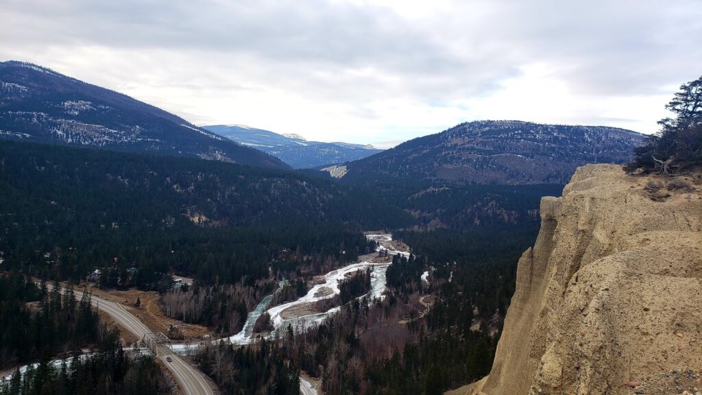
Radium Hot Springs is truly spoiled with views. Situated between the Purcell and Rocky mountain ranges, you’ll see why we are referred to as “the Valley of a Thousand Peaks.” The Columbia River Wetlands are the largest in the world, offering quiet space for walking, biking, and taking in the river views. There are no shortage of water features either, with trails lining the Sinclair Falls, Lake Windermere, Lower Bugaboo Falls, and more.
From a gentle stroll to an all-day adventure, you’ll find the right trail in Radium!
Easy Hikes
Easy hikes are perfect for everyone to enjoy. You don’t have to complete the full trail to enjoy the view!
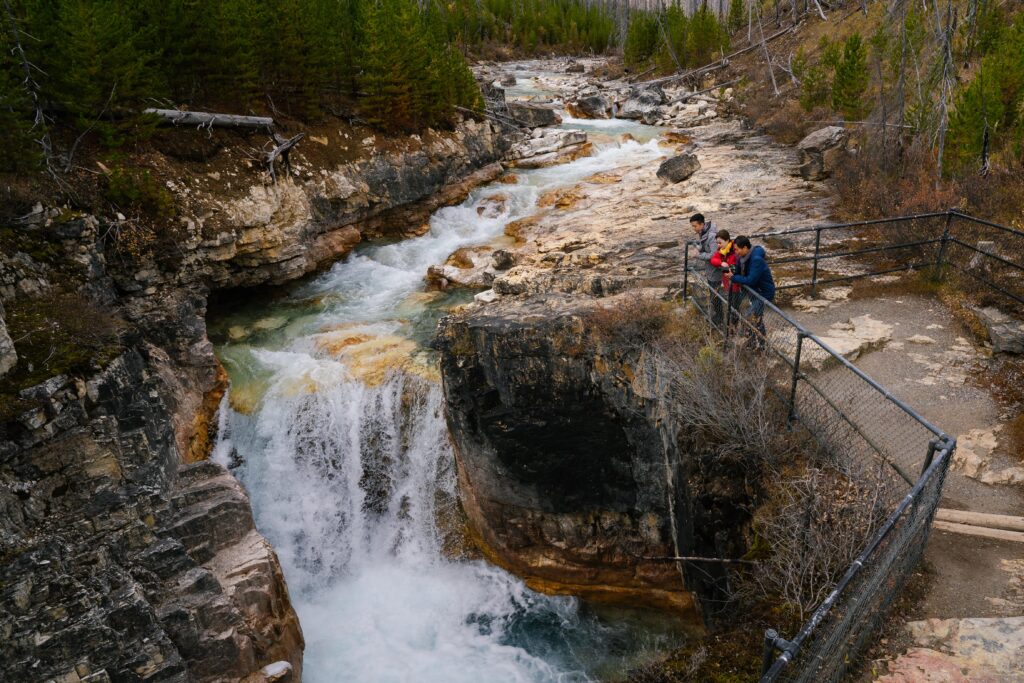
Sinclair Creek Trail
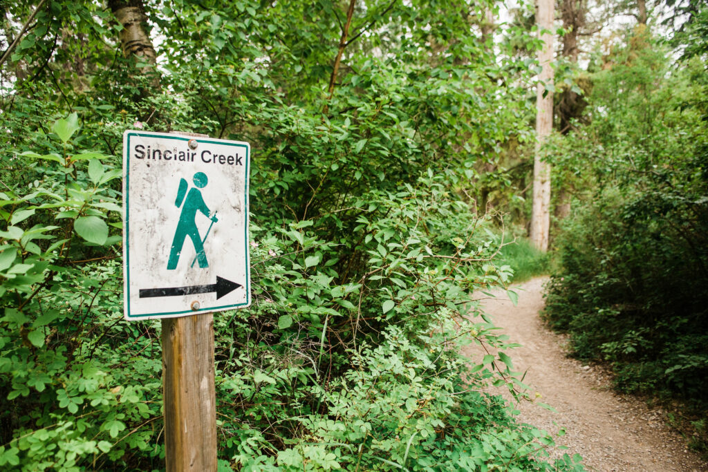
Distance: 3.5 km loop
A short walk with interpretive signs along Sinclair Creek. This space is also a biking trail with access to the Pump and Jump track, and an off-leash area for dogs. To complete the whole loop, expect to spend about 45 minutes. For a shorter outing, the Sinclair Creek picnic area is a delightful visit.
Access: The trailhead can be accessed through Rotary Park (across from the Prestige Hotel) or by travelling west down Forsters Landing Rd. At the bottom of Forsters Landing Rd., turn right at the 4-way intersection before the mill, then follow the gravel road around the mill yard to reach the trailhead and picnic area.
Old Coach Trail
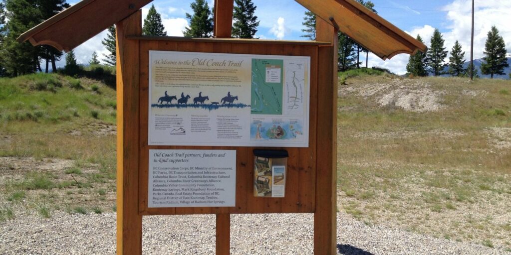
Distance: 9 km
The Old Coach Trail winds above the Columbia River Wetlands, perfect for walking or mountain biking. The Old Coach Trail is an out-and-back system, meaning that it can be as long as you’d like! Walk for just a few minutes or head out for a longer stroll — you will bask in beautiful views of the Columbia River Wetlands either way!
Access: From Radium, head south 5.5 km and turn right off Hwy 93/95 at the blue tourism trail signs indicating Old Coach Trail. There is a large, gravel parking area. Trail can also be accessed at the south end of Main Street West in Radium Hot Springs.
Juniper / Sinclair Trail
Distance: 3 km
This trail leads down to a viewpoint of Sinclair Creek and Falls before travelling up Sinclair Canyon, ending at the Radium Hot Springs Pools. Note: National Park Pass required.
Access: Just inside the entrance of the Kootenay National Park, you will see a small parking lot to the north. Park here and begin the trail, heading down to Sinclair Falls. Or park in the north lot of the Pools and take the trail up from the old access road.
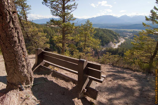
Valley View Lookout
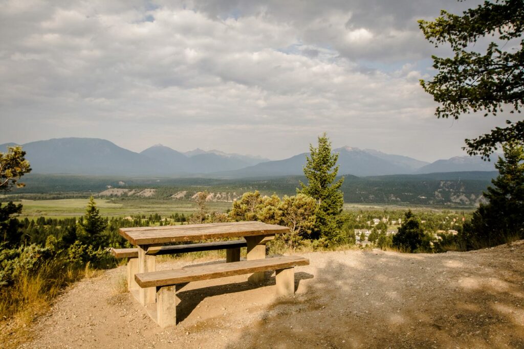
Distance: 1 km
Hike up a set of stairs leading to a beautiful lookout of the Purcell Mountain Range and the Village of Radium Hot Springs. This trail can be extended further on to the Redstreak Campground trails, if desired.
The Valley Viewpoint can also be accessed by driving towards Redstreak Campground.
Access: This hike can be accessed directly behind the Radium Visitor Information Centre.
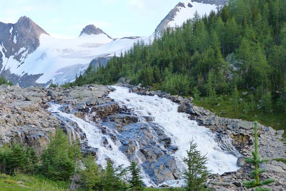
Lower Bugaboo Falls
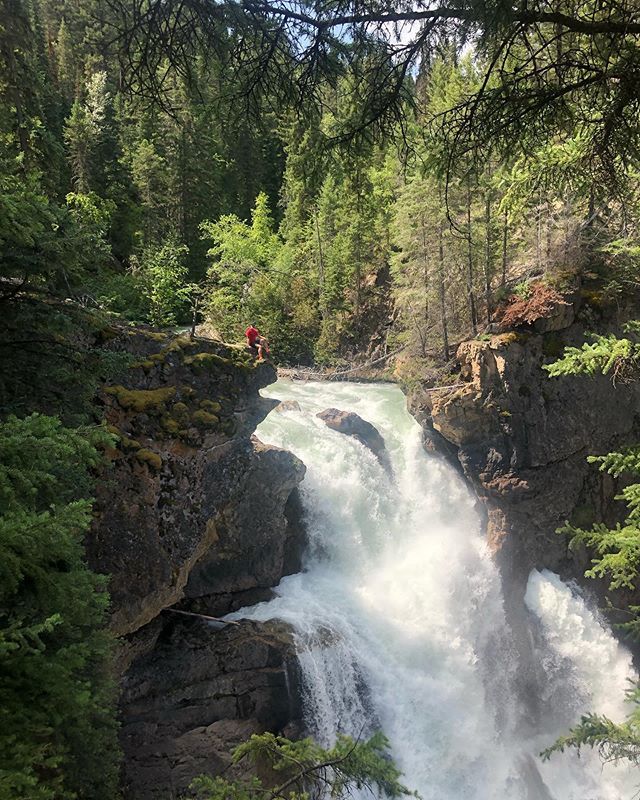
Distance: 3 km
This trail has an easy uphill grade leading to the Bugaboo Creek lookout, which showcases plunging falls. Use extreme caution around the falls; the rocks are wet and slippery.
Access: Travel north from the Radium traffic circle on Highway 95 for 25 km to the village of Brisco. In Brisco, turn left at the Bugaboo Provincial Park sign to head West on Brisco Road. The pavement turns to gravel at this point. Proceed for 5 km to where the road splits, taking the road to the right, reaching the trailhead at the 8.5 km mark, parking on the left.
Nipika Mountain Resort
With an extensive network of 50 km there are plenty of options to choose from when hiking at Nipika Mountain Resort.
Hike the trail system to discover beautiful mountain, river, and valley views.
Access: Head east at the traffic circle in Radium, taking Highway 93 into Kootenay National Park (No park pass required if driving through to Nipika.) Turn right onto Settler’s Road, about 20 km from town. At the 12 km marker on Settler’s Road, turn left onto the Palliser Forest Service Road. Cross the Kootenay River Bridge, drive up the hill, and turn left into the Nipika Day Use parking area.
Wilmer Wetlands
Distance: 5 km
Take a walk through the terraced bluffs above the Columbia River Wetlands. This is a great place for quiet time, viewing local flora and fauna, and birding.
Access: From Invermere, follow the main road through town and turn right on Panorama Drive, following the road out of town past the Ray Brydon Dog Park. Cross Toby Creek and follow the signs to Wilmer on the right. Once in Wilmer, turn right on to Main Ave and follow; this will turn into Westside Road, and follow for about 2 km. The Wildlife Refuge will be marked on the right by the parking lot and kiosk map.
The Wilmer Wetlands are located within the Columbia National Wildlife Area (NWA). The CWA provides valuable habitat for many Species at Risk such as the American badger, Lewis’ woodpecker, and western painted turtle. When hiking, make sure to follow guidelines such as keeping dogs on leash, carry out all trash, and do not disturb any natural material.
Markin – Macphail Westside Legacy Trail
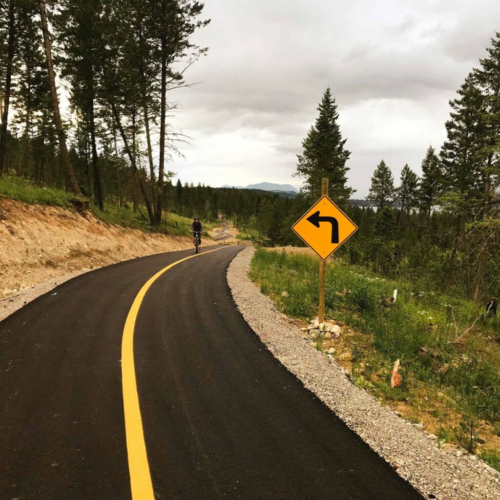
Distance: 25km
A paved walking and biking trail connecting the communities of Invermere and Fairmont Hot Springs. Although paved, the trail offers sweeping views of Lake Windermere and the Rockies with interpretive signs, picnic areas, and benches along the way.
Note: Dogs are not permitted on this trail.
Access: From Invermere, travel south on main street (7th Ave), turning right on 13th Street (at the CIBC), then left on 13th Avenue. This road turns into Westside Road; the trailhead will begin just after the Castle Rock Development, on the right (west) side of the road. There are two other parking areas along Westside Road.
Hoodoos Trail
Distance: 3.5 km
A short hike with great views of Columbia Lake and Dutch Creek. The Hoodoos Trail offers exploration of this stunning geographic feature and vegetation. Stay left when the trail forks; this will allow you to complete a loop around the hoodoos.
Access: Travel south on Hwy 93/95 to Fairmont Hot Springs and past the town. After crossing the bridge over the train tracks, take the first right on to Westside Road. Follow for 1.5 km and turn left into a large rectangular gravel parking lot labeled for the Hoodoo trail. The trail starts by passing through a large gate.
Olive Lake
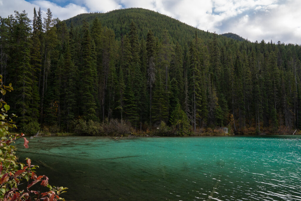
Distance: 0.3 km
A short hike true to its name, Olive Lake is a beautiful quick stop to stretch your legs in the Kootenay National Park! It’s a short and stunning boardwalk stroll along the bright green lake with interpretive signage and perfect photo opportunities. Note National Parks Pass is required.
Access: Access: From Radium head towards Banff on the Highway 93. The trail head is 12 km east of Radium. There will be signs that will indicate to turn right into a parking lot.
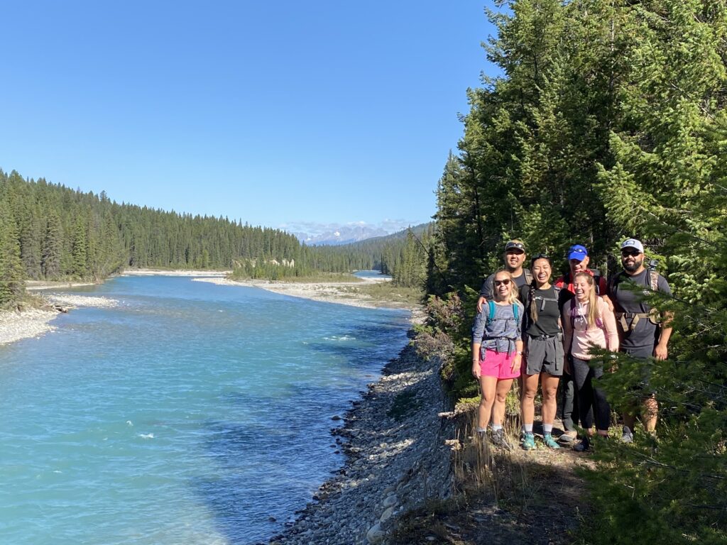
Dog Lake

Distance: 2.6 km
A wonderful hike for families! Cross two suspension bridges on the Kootenay River. Bring a packed lunch and picnic at Dog Lake to enjoy the views before hiking back to your car. Note National Parks Pass is required.
Access: From Radium head towards Banff on Highway 93. Drive for 28 km and then follow the Dog Lake signs and turn right on McLeod Meadows Road
Simpson River Trail
Distance: 8.8 km
Learn about the importance of forest fires by walking through a forest marked by fire! With interpretive signs about forest fires, you will learn something new as you experience the aftermath of a forest fire. Be sure to take a picture in the iconic Red Chairs. Note National Parks Pass is required.
Access: From Radium head on Highway 93 toward Banff. The trailhead is 57 km east of Radium. Follow the signs and you will turn right into a parking lot.
Paint Pots
Distance: 1 km
A short walk that takes you to three bright orange, iron-rich mineral springs that stains the earth around them. Note National Parks Pass is required.
Access: Head on Highway 93 toward Banff. Drive for 86 km. The Paint Pots parking lot will be on the left-hand side of the road.
Marble Canyon
Distance: 0.9 km
Experience the beautiful bright blue water of Tokkumm Creek from the several criss-crossing bridges above. Marble Canyon is a short walk with big reward! Check out Marble Canyon in the winter to see the amazing ice formations. Note National Parks Pass is required.
Access: Head on Highway 93 toward Banff. Drive for 86 km. The Paint Pots parking lot will be on the left-hand side of the road.
Moderate-Difficult Hikes
Mount Swansea Recreation Area
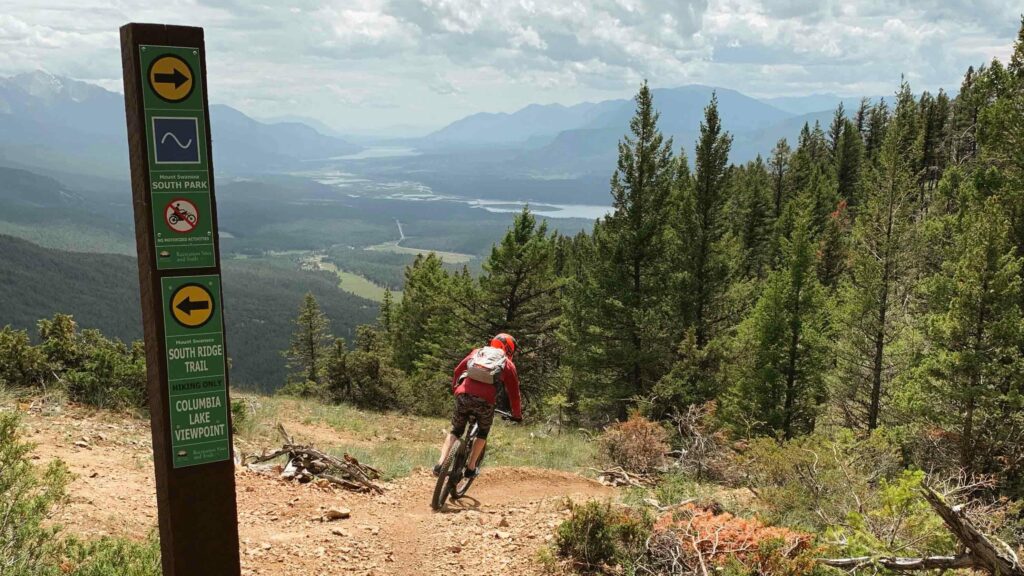
Distance: 6.3 km/745 m elevation
Mount Swansea is a beautiful hike near Invermere. Offering panoramic views of the Columbia Valley, this is a great day hike. There is also a popular network of bike trails and a launchpad for paragliding.
Access: From Invermere, travel south on Highway 93/95. Take a left turn after the Valley Alley Gas Station onto Windermere Loop Road. Travel on this road for about 3.5 km, turning left at the wooden sign for Mount Swansea.
Pedley Pass
Distance: 5.1 km/450 m elevation
A great family hike, this trail leads through the aptly named Bumpy Meadows to the pass for great views of the area.
Access: AWD vehicle required. Follow directions to Mount Swansea. At the wooden sign, immediately turn right onto the paved Westrock Mine Haul Rd. Drive with caution, this is an active mining road. At 8.5km the road turns to gravel, stay to the right at the fork. At 14km stay to the left past the mine. The road then narrows, roughens, and the kilometer markings stop at this point. Follow the main road, avoiding branch roads. The trailhead is at the end of the main road.
For more trail information please visit the Recreation Sites and Trails BC website here.
Diana Lake Trail

Distance: 6.2km/600 m elevation
This trail takes hikers through open meadows and subalpine forests to a tranquil lake. Enjoy treats from Diana Lake Lodge & Teahouse at the end of the trail.
Access: High-clearance, AWD vehicle recommended. From Radium, travel north on Hwy 95 for 16.5km. Just before Spur Valley, turn right onto Kindersley-Pinnacle Creek FSR. Just beyond the 7km mark, take a left onto the Pinnacle Creek Rd. Stay left at 8.5km and right at 11km. Stay left at the 14.5km marker. Stay right at the 15km, 23.5km and 24km, with the trailhead at the 25km mark.
Welsh Lakes Trail
Distance: 3.9km/465m elevation
A steep hike through forests and rocky slopes to an amazing group of alpine lakes.
Access: High-clearance, 4WD vehicle recommended. From Radium, travel west down Forsters Landing Road and take the left turn on to Horsethief Creek FSR, following this road for 9km, staying left at the 3km mark, to the 4-way intersection with Westside Road. Continue straight through the intersection. At the 13km mark stay right and follow the green sign for the trail. Follow this road past a water reservoir staying left on Forster Creek FSR. At the 36km marker a sign for the trail points to the left. You can drive this section, or park and hike the 1.6km road.
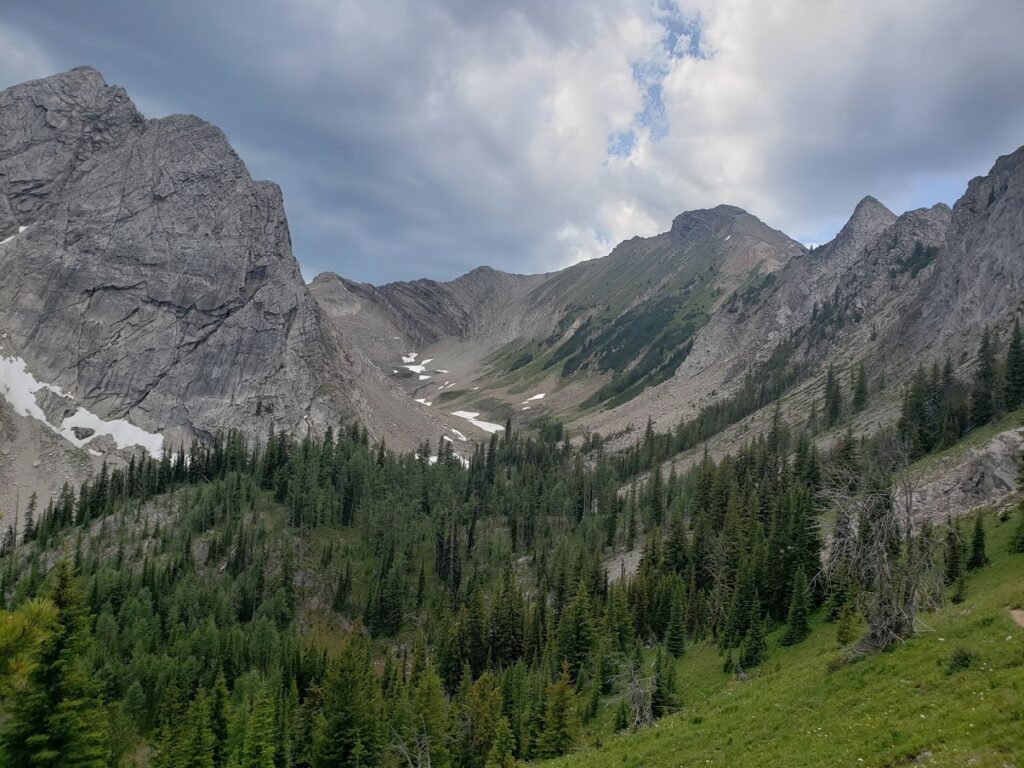
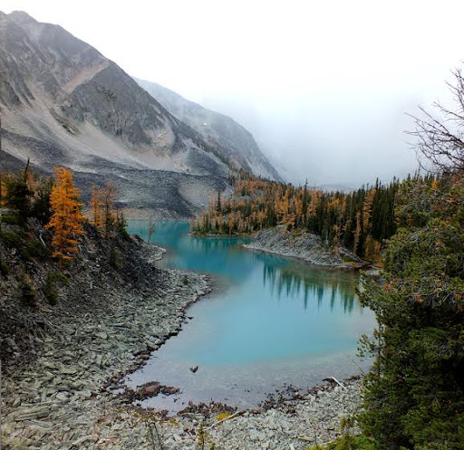
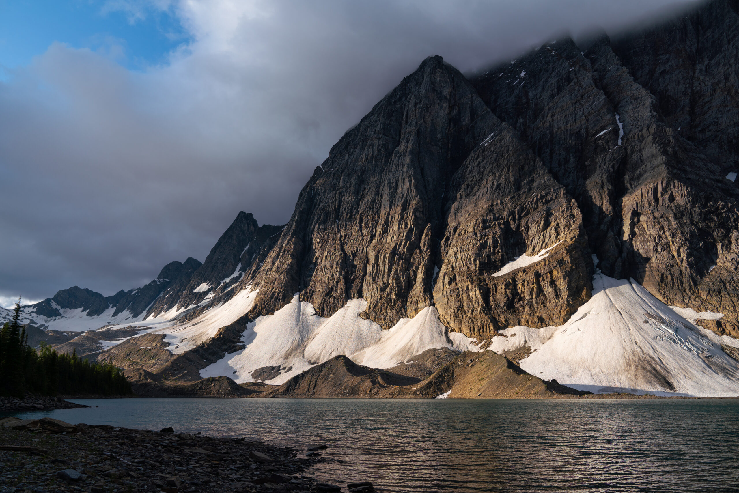
Lake of the Hanging Glacier
Distance: 8km/730m elevation
One of the iconic hikes in the area! This well-used trail leads hikers to a beautiful alpine lake with a glacial backdrop.
Access: High-clearance, 4WD vehicle recommended. From Radium, travel west down Forsters Landing Rd and turn left on to Horsethief Creek FSR at the intersection before the mill. Follow this road for 9km, making sure to stay left at the 3km mark, to the 4-way intersection with Westside Road. Continue straight through the intersection. At 13km, stay to the left. At the 27km mark stay right, and again at the 42km mark. Continue following the road to the 48km mark, being careful of washouts in the road. The trail starts from the right side of the parking lot. Hike accessible late June-October, dependent on bridge installation.
Conrad Kain Hut – Bugaboo Provincial Park
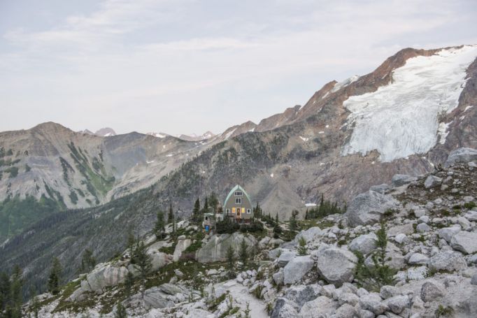
Distance: 4.6km/660m elevation
This short but steep trail gives access to one of the most renowned alpine climbing areas in North America.
Access: High-clearance, AWD vehicle recommended. Travel north of Radium on Hwy 95 for 25km to the town of Brisco. In Brisco, turn left at the Bugaboo Provincial Park sign to head West on Brisco Road. Proceed on Brisco Road for 5 km to where the road splits, and take the left following the Bugaboo Park signs. At the 7.5km mark, turn right on to the Bugaboo FSR. The km markers reset to 0 at this point. Follow the road, watching for Bugaboo Provincial Park signs and the parking lot.
Floe Lake
Distance: 10.5 km/ 1,110 m Elevation
A hike that will burn the hamstrings! A steep trail with sunny spots and beautiful views along the way which will lead you to a picturesque lakeside destination. Note National Parks Pass is required.
Access: From Radium drive towards Banff on the Highway 93. The trailhead will be 72 km away from Radium. The parking lot will be on the left.
Stanley Glacier
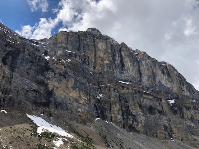
Distance: 5.2km/ 615 m Elevation
The Stanley Glacier Trail is a fantastic day hike in Kootenay National Park! Hike up to the stunning alpine basin, see the Stanley Glacier and meltwater fall down the rock walls. Note National Parks Pass is required.
Access: From Radium drive towards Banff on the Highway 93. The trailhead will be 91 km away from Radium. The parking lot will be on the right.
Please note that all distances are one-way. Always remember to pack food, water, and extra clothing on your adventures. Take a look at our full list of hiking safety reminders here. For more information, stop by the Radium Visitor Information Centre. Guided experiences are available.
Important Links
- Summit Trail Makers Society
- Kootenay National Park Hiking Trails
- Kootenay National Park Trail Report
- Playwest Mountain Experience
Service Providers
Contact these local businesses for everything you need for your next adventure.